The toolbox for professionals
A single platform bringing together various applications for the exploration and detailed analysis of 3D data.

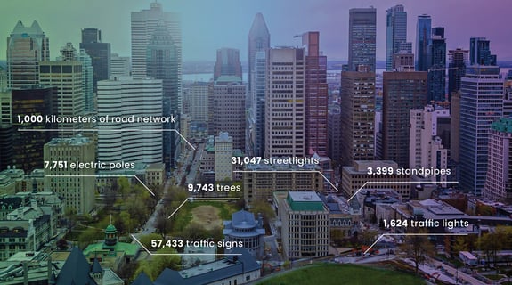
Jakartowns, as if you were there!
More than 100 000 km of point cloud data available instantly!
Our web-based viewer simplifies the process of accessing massive Lidar and imagery data, allowing for the analysis, measurement, and geocoding of city assets