A proven platform, large-scale data, and measurable results
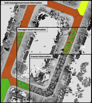
Digital Twin and Asset Management
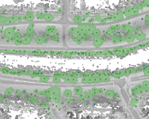
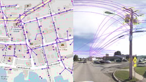
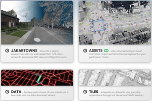
An intuitive platform for quick access to 3D mobile mapping, LiDAR, 360° imagery, and 2D data for asset management and urban planning.
Visualize, analyze, and leverage data to make informed decisions.
Accelerate processes, reduce costs, and improve the efficiency of your operations.
Reality Capture!
We capture reality with high-definition LiDAR and 360° imagery to create engineering-grade precision digital twins.
Available across Canada, the United States, and Europe, where we integrate geospatial data seamlessly into our mobile mapping data management platform.

Trusted by leading organizations
Municipalities and organizations that rely on trusted data to better manage their infrastructure