
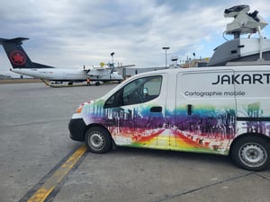
Canadian Urban Forest Conference 2026: Jakarto in Quebec City
Jakarto and PlanIT Geo will be in Québec City for the Canadian Urban Forest Conference ...
Jakarto at TAC 2026: LiDAR Supporting an Award-Winning Project in Québec City
Meet Jakarto at TAC 2026 in Winnipeg, October 4–7, and discover Québec City’s ...
Jakarto’s 360° Imagery in ArcGIS Experience Builder
Discover Jakarto’s latest plugin for ArcGIS Experience Builder. Explore 360° imagery ...
The Jakarto Platform Is Evolving: A New Visual Experience Is on the Way
Jakarto is progressively modernizing its platform interface to deliver a more consistent, ...
Need to analyze freeze-thaw issues? Now is the ideal time to spot them
Analyze freeze-thaw issues before the season ends with LiDAR surveys and identify road ...
Urban forestry: why choose between cutting-edge technology and human expertise?
Urban forestry reimagined: combine LiDAR precision, expert field validation, and ...
The Catch Basin Gate by Jakarto!
A Québec city thought it had 300 catch basins. A digital twin revealed nearly 600. ...
One Platform. One Universe.
A global cloud infrastructure for hosting, streaming, and scaling LiDAR and 360° ...
What’s New in the Jakarto Platform: More Clarity, More Context
Discover Jakarto’s latest platform updates: improved Asset Viewer, colorized LiDAR, and ...
Jakarto at Geo Week 2026: the platform at the heart of the geospatial ecosystem
Jakarto at Geo Week 2026 presents its cloud LiDAR and 360° platform for digital twins and ...
A New Generation of Mobile Mapping Units at Jakarto
Explore Jakarto’s next-generation mobile mapping units combining LiDAR, 360° imagery, and ...
2026: The Digital Twin as the Foundation of Urban Decisions
Discover how digital twins support urban decision-making by providing cities with ...