.png?width=300&name=Jakarowns_Split%20(1).png)
Unlock the Value of your mobile mapping Data
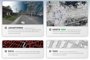
Discover The Jakarto platform!
LiDAR and 360° Imagery Data Management
Cloud-based hosting, processing, and distribution solutions for mobile mapping data (LiDAR and 360° imagery).
A solution that ensures secure and efficient access to your geospatial information.

Lidar & 360 Imagery
- Jakarto Mobile Mapping Unit

Other's mobile mapping data feed :
- Z&F, Trimble, Riegl, Leica
The digital twin access!
- Measure distances, size, clearance and areas
- Easily get XYZ coordinates of any object
- Import and Export geospatial Data in the viewer
- Navigate in free flight mode
- Historical mapping passes access


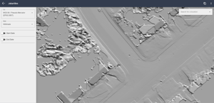
When 3D becomes 2D
Real-time generation from your point cloud data, providing
current and precise visualization layer in any GIS.
TOUCH
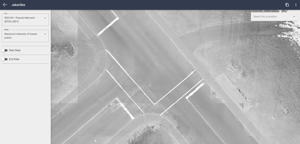
2D Intensity Raster
2D Intensity Raster
TOUCH
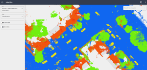
2D Classification Raster
2D Classification Raster
TOUCH
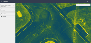
Verticality Raster
Verticality Raster
TOUCH
2.5D Hillshade Raster
2.5D Hillshade Raster


.png?width=300&height=104&name=Data%20(3).png "Data (3)")
Fast-Track LiDAR Data accessibility
Quickly access LiDAR & 360 imagery data online
Cloud based Data Storage solution
Effortlessly access, manage, share, and work with data online
Improve your productivity
Harness the full potential of geospatial data instead of merely managing it