Platform
Our library of applications.
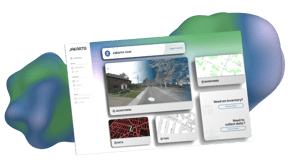
The new Jakarto platform serves as a comprehensive toolbox for professionals in cartography, planning, and spatial data analysis:
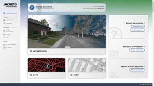
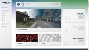
- Jakartowns immerses you with a full 3D point cloud visualization. Explore, measure, and interpret data to extract the information that matters to you.
- Tiles, our new application, revolutionizes the visualization and integration of raster tiles into your Geographic Information System (GIS).
- With Data, our point cloud download service, obtain LiDAR data specific to your chosen area and easily integrate it into your point cloud software for in-depth analysis.
- The Jakartowns API provides a direct and simplified connection between Jakartowns and your inventory. Integrating Jakartowns into your systems has never been easier.
The toolbox for professionals
A single platform bringing together various applications for the exploration and detailed analysis of 3D data.