
News on Jakartowns, our SaaS solution for online visualization and exploitation of Jakarto data.
Many new functionalities have appeared in Jakartowns in recent months. We are proud of the team's accomplishments continuously improving this web application.
Here are 4 new features worth mentioning:
- Choose the background layer for the 2D reference map;
- Add a Jakarto data layer on the 2D reference map;
- View aerial data, including those of Montreal;
- Produce an inventory manually with a game controller.
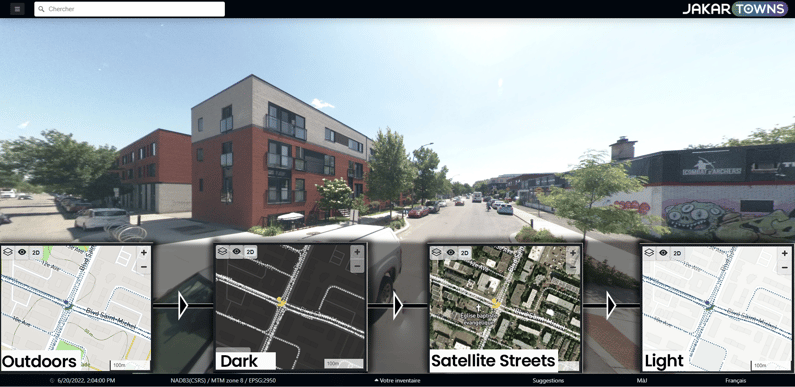
1. Choose the background layer for the 2D reference map
It is now possible to change the base layer used in the dynamic 2D reference map at the bottom left in Jakartowns.
Simply use the 1st button on the left (the 2-layer icon) and choose from several base maps: Light, Outdoor, Dark, Street, Satellite Streets.
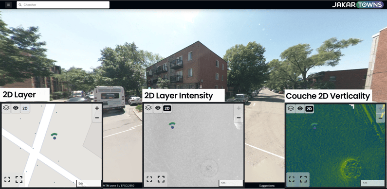
2. Add a Jakarto data layer on the 2D reference map
You are now able to enhance the 2D reference map by displaying the Jakarto layer, containing raster images of your sector produced with our LiDAR data.
Use the 3rd button (the 2D icon) to display Jakarto LiDAR data flattened (2D) depending on the availability of several years of capture (2019, 2020, 2021, 2022). Two styles are offered "Intensity" (illustrating different levels of reflectivity according to the LiDAR sensors) or "Verticality" (original way of showing the relief and the sharp breaks in the digital terrain model).
The richness and level of detail of these images will allow you to better visualize the cracks, the markings on the ground, the manholes, the curbs...
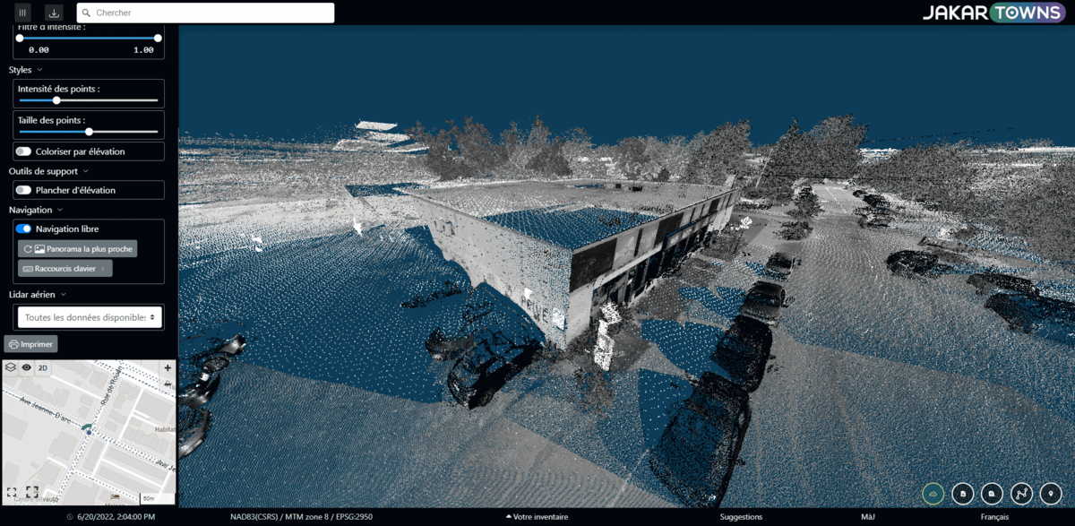
3. Visualize aerial data, including those of Montreal
It is even easier to enrich and complete our data captured from the street in mobile mapping with airborne LiDAR data. We have added those of the city of Montreal (2015, info on the source here, in French), for a global and complete view of the territory! The best of both worlds.
To see this data, you must be in the "Point Cloud" view mode (cloud icon at bottom right). Then, via the vertical toolbar on the left (3-line icon), several options are offered including, the very last one at the bottom, choosing "Aerial Lidar (2015)" from the list.
Contact us if it is important for you to merge/mix airborne data over ours for your area of interest if you are a Jakartowns subscriber! We will assess the possibilities.
4. Produce an inventory manually with a game controller
What was possible with a keyboard and mouse is now possible with a game controller. It is now even easier to explore, measure and generate manual inventories in your city. Jakartowns now allows you to navigate with a controller plugged in as a peripheral to your computer. Creating an inventory has become child's play!
Just a reminder: While you can do inventories yourself on the screen, know that Jakarto also offers AI-powered data processing services to automate and speed up the process across large territories. Consult our product catalog to see the possibilities.
COMMENTS