PAVEMENT CONDITION
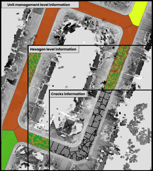
Pavement Quality: 3 Levels of Analysis
Our model is structured across three complementary analysis scales to support both engineers and asset managers.
1. Strategic View — Management Unit level
Ideal for budget planning and prioritizing work by street segment.
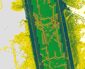
2. Hexagonal View — Field level
Localized analysis to identify critical zones within the same road segment.
3. Micro View — Crack level
High-precision geometric mapping of each defect for engineering-grade analysis.
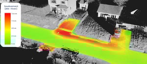
Freeze–Thaw Analysis
Using 3D LiDAR surveys captured at different times of the year, Jakarto detects and measures seasonal pavement heave, then maps it to help municipalities identify vulnerable areas, prioritize interventions, and monitor change over time—an approach already deployed with the City of Québec.
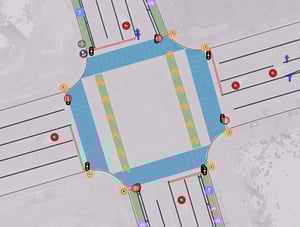
Pavement marking
Jakarto automates the inventory and assessment of road markings using the digital twin.
Quickly identify sections that need refreshing, prioritize interventions, and coordinate work with pavement maintenance teams.
Detect change and validate work performed (before/after, coverage, compliance) to improve quality control and simplify reporting.
Trusted by leading organizations