Road Signs
A complete inventory with full context
Each inventoried sign includes attributes designed for municipal operations and seamless system integration:
- Unique ID, position, and sign orientation
- Associated support and sign order on the support
- Class and P-code
- Clearance below the sign
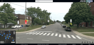
- Visualization link in the digital twin (Jakartowns)
-
Scan date
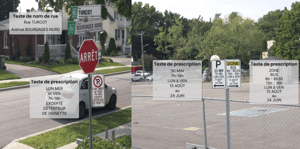
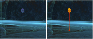
Text recognition (OCR)
Jakarto can extract and structure visible text from traffic signs to support standardization, rule updates, and consistent enforcement of municipal policies. This includes:
- Street name sign text
- Parking and regulatory sign text
- Time-based conditions: hours, days, periods, and exceptions
- Supplementary signs and informational signs
AI-powered
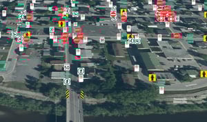
Jakarto automates traffic sign inventories using AI applied to the digital twin.
Algorithms detect and classify signs, assign key attributes (e.g., type, P-code, support), and enable the extraction of useful content (e.g., street names, parking rules).
The result: fewer field visits, faster updates, and a standardized inventory ready for your systems.
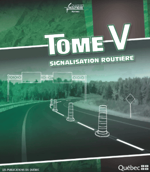
MTQ standards & sign coding (P-code)
To support compliance and standardization, Jakarto assigns a P-code to each inventoried sign.
In Québec, this coding is based on the Tome V – Traffic Control Devices (MTQ / MTMD). It is complemented by a Jakarto-developed library that covers signs not governed by the ministry, ensuring consistent classification for GIS and asset management workflows.
Jakarto’s solution is now also compliant with the standards of the New Brunswick Department of Transportation and Infrastructure, enabling the same coding and standardization approach for organizations in New Brunswick.


Trusted by leading organizations