Tiles
Integration of raster data.
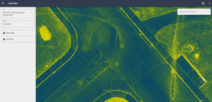
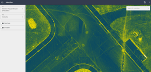
Tiles is a web service offered by Jakarto, allowing users to visualize geospatial data in the form of raster tiles. This service is accessible through a subscription to the Jakarto platform and plays a key role in the manipulation and analysis of urban data.
Key Features of Tiles:
Real-Time Generation: Tiles are dynamically generated from point clouds, offering up-to-date and accurate visualization.
Various Formats: Supports formats such as XYZ tiles and WMTS, which can be easily integrated into Geographic Information Systems (GIS).
Type of Rasters
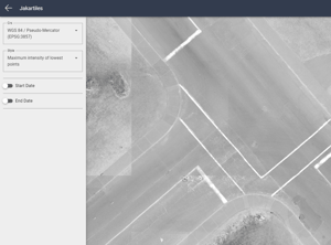
- 2D Raster: Various styles to illustrate the territory based on reflectance intensity or maximum intensity.
- 2D Ground Raster: A specific representation of the ground. The absence of trees in this layer provides a clear view of the ground, allowing for a more precise analysis of the underlying surface.
- 2D Lowest Maximum Points Raster: This style combines the two previous ones, highlighting the lowest points with the highest intensity.
- 2D Classification Raster: Categorization of urban elements such as vegetation, buildings, vehicles, etc.
- Verticality Raster: Highlighting vertical discontinuities in urban environments.
- 2.5D Shadow Raster: Illustrating elevation differences, providing an additional perspective in terms of height and relief.
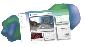
Explore Tiles on our Platform
A single platform bringing together various applications for the exploration and detailed analysis of 3D data.