
✨ ReImagine: envision what’s next, starting with reality
With ReImagine, the new feature in Jakartowns, bring your planning ideas to life with artificial intelligence.
A new neighbourhood park, an intersection transformed into a roundabout, or a street redesigned for pedestrians and cyclists? Your imagination is the only limit!
Using the street-level imagery available in Jakartowns, simply describe the transformation you have in mind. ReImagine generates a visual concept in the context of your chosen location.
📍 Your ideas, grounded in your community
By drawing on recent images of places you know, ReImagine makes your planning ideas more tangible. Explore possibilities, spark discussions with colleagues and shape a shared vision.
🗣️ An ideal tool for preparing presentations to residents
Help residents picture change in places they recognize. With ReImagine, illustrate your ideas using recent street-level views to make your presentations more concrete and accessible.
These visual concepts can support public consultations, encourage feedback and enrich discussions with the community before moving on to detailed design.
🎨 Try it in Jakartowns
ReImagine is available directly in the menu bar on the left side of Jakartowns. Navigate to the location you are interested in, open ReImagine and describe your idea.
Which place will you reimagine first? 👇 Three examples to inspire you ✨
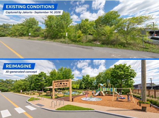
🌳 Imagine a park for neighbourhood children
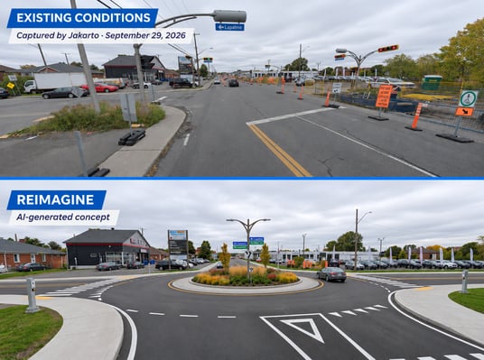
🔄 Transform an intersection into a roundabout
🚲 Redesign a street for active transportation
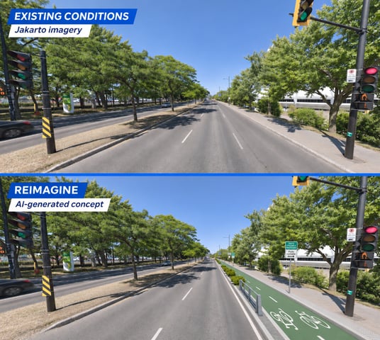
The generated visuals are conceptual proposals; their dimensions and feasibility must be validated by your design teams.
💡 Your community, new possibilities
Tomorrow’s projects begin with today’s ideas. With ReImagine, use real-world imagery captured by Jakarto to explore designs, share your vision and open a dialogue with residents.
Open Jakartowns and bring your next idea to life!

COMMENTS