.png?width=300&name=Jakarowns_Split%20(1).png)
Maximize the value of mobile mapping data
Simplified management of LiDAR and 360° imagery data
Cloud-based hosting, processing, and delivery solutions for mobile mapping data (LiDAR and 360° imagery).
A solution that ensures secure, high-performance access to your geospatial information.
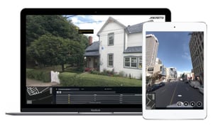
Virtual Surveying—Made Real!
- Measure distances, dimensions, clearances, surface areas, and more.
- Easily retrieve precise XYZ coordinates for any object.
- Quickly import and export geospatial data.
- Effortlessly manage your data history.

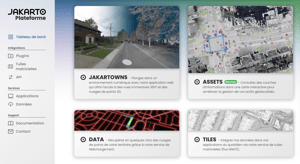
Asset Viewer
A clear view of the extracted assets across from te digital twin. Directly connected to the digital twin.
An integrated GIS tool within the Jakarto platform.
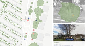

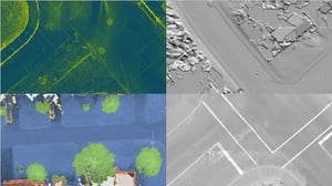
When 3D Becomes 2D!
Real-time LiDAR raster tiles for accurate 2D visualization, seamlessly integrated with any GIS.
2D - Ground - Classification - Verticality - Hillshade - Colorized

Connect Jakartowns to your systems!
Easily integrate our digital twin data into your GIS, BIM, and other business environments with our plugins.
Ensuring fast, seamless interoperability.

.png?width=300&name=Data%20(3).png)
LiDAR Data Download
Our LiDAR data download service lets you select precise areas using a polygon to retrieve the .LAS files you need.
Reduce processing and analysis time by getting the right data at the right moment.


Connect Jakartowns to your systems!
Easily integrate our 3D viewer into your GIS and other business applications.
Ensuring seamless interoperability, reducing integration efforts, and improving efficiency.

Seamless Access
Enjoy simple, fast access to LiDAR data and 360° imagery—for optimal visualization and analysis of your data.
Unlimited Storage
Access, manage, collaborate, and share your data online with our secure cloud storage solution—offering maximum flexibility and accessibility.
Productivity Boost
Unlock the full potential of geospatial data without getting lost in project management and data layers.
Trusted by leading organizations
Municipalities and organizations that rely on trusted data to better manage their infrastructure