
Fire Hydrants
Fire Hydrant Inventory
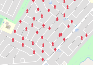
Jakarto’s fire hydrant data provide precise geolocation (X, Y) for hydrants along the road network, helping municipalities quickly locate and manage these critical assets.
Inventory data include:
- 2D data: Data file (.shp) containing the geolocation of each fire hydrant
- Jakartowns context link: Each asset includes a clickable hyperlink that opens Jakartowns directly at the hydrant location to visualize the surrounding geographic context
Trusted by leading organizations