Jakartowns
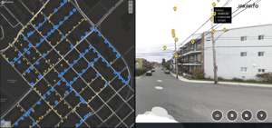
Viewer that eases access to LiDAR and 360 imagery data
Jakartowns, as if you were there!
More than 120 000 km of point cloud data available instantly!
Our web-based viewer eases massive Lidar and imagery data access to analyze, measure, geocode and manually inventory city asset.

Jakartowns eases Lidar and 360 imagery data access
Engineering grade tool, allow users to reduce drastically time on the field!
Virtually do asset inventory in the digital twin and easily export in your databases.
Geographic data format
Jakarto data is made available in a widely used format in the GIS, CAD and MDB software industry.


