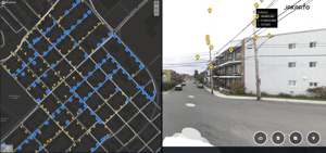
Access digital twins created from over 150,000 km of LiDAR and 360 imagery collected in Eastern Canada, directly in Jakartowns.
-
Visualize coverage, track updates from our mapping campaigns, and leverage reliable data to speed up asset inventory, planning, and maintenance.