The toolbox for professionals
A single platform bringing together various applications for the exploration and detailed analysis of 3D data.

Jakartowns, as if you were there!
More than 100 000 km of point cloud data available instantly!
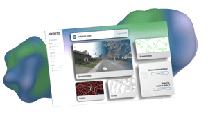
Our web-based viewer simplifies the process of accessing massive Lidar and imagery data, allowing for the analysis, measurement, and geocoding of city assets

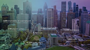
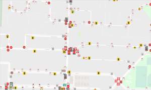
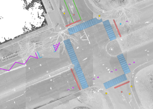
Automated Asset Inventories
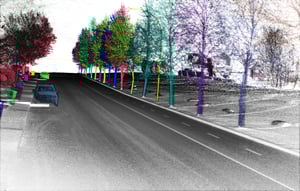
At Jakarto, we use AI to detect specific objects in a geospatial dataset.
From the field to the web in 72 hours

Generated from Lidar and 4k imagery, view from the street
Learn more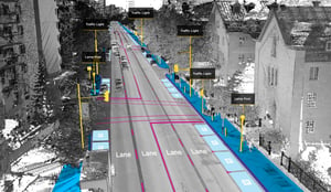
Thanks to the digital twin and artificial intelligence algorithms
Learn more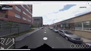
Tools for processing, transforming and publish large-scale LiDAR data
Learn moreDigital Transformation
The Digital Twin and data enable better asset and infrastructure management and inspection, change detection, inventory, and condition analysis, used in design and planning. More accessible data for engineers, geographers, and land infrastructure managers.

%20(1).jpg?width=300&name=_03_3d_04_detection_5_poteaux_8%20(2)%20(1).jpg)
